Next Steps
Though we were unable to experiment with ArcGIS Indoors - we explored its documentation to gain a better understanding of it’s use in the indoor mapping world. From a 2D floorplan - ArcGIS Indoors can extract features such as walls and doors, as well as annotate extracted features with information such as room name and use. Utilizing machine learning algorithms such as convolutional neural networks (CNNs) or graph-based methods - these models learn to recognize and interpret the features of the newly created indoor environment.
Map generation within ArcGIS Indoors allows for detailed layouts, pathways and navigation between rooms and floor levels. ArcGIS Indoors even allows for the user to determine precise location through localization techniques such as Wi-Fi signals.
ArcGIS Indoors allows for the development of user-friendly interfaces and applications to allow access to the indoor mapping - providing navigation instructions, route planning, point of interest look-up and real-time updates.
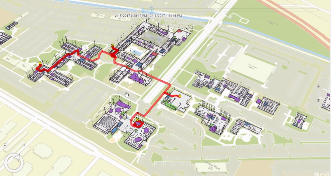
ArcGIS Indoors Routing Example - Image via Eric Van Rees
Group 4 Testimonials
Experience Builder

“An accessible application for presenting data in a variety of ways! Lots of available widgets to configure to customize the user experience. However, licensing constraints can hinder this solution from producing truly amazing results for indoor spaces.” – Chloë, Group 4
ArcScene

"Proven to be a great tool to bring 2D floorplans to life in an interative, 3D space. Easy workflow to follow, can build a 3D render in minutes!" - Andie, Group 4
InstantApp

"An easy-to-use resource to create an interactive app for a variety of users" - Tali, Group 4
QGIS/Leaflet

"QGIS being an open source tool offers solutions that can cost thousands of dollars in a commercial GIS setup.For solution to indoor navigation, creating floor plan using QGIS seems mandatory because the advance editing feature is not available for propitary data layers. Should have access to Indoor Mapping Tool" - Rajesh, Group 4
ArcGIS Indoors
"ArcGIS Indoors looks like a promising solution for indoor mapping initiatives! A disadvantage is the special license you must obtain to utilize this ArcGIS extension - looks pricey too!" - Group 4, collectively